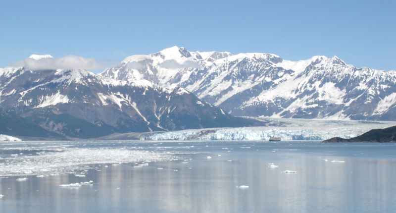
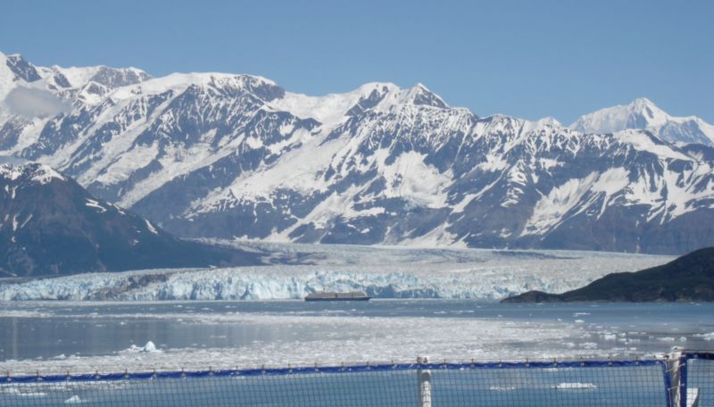
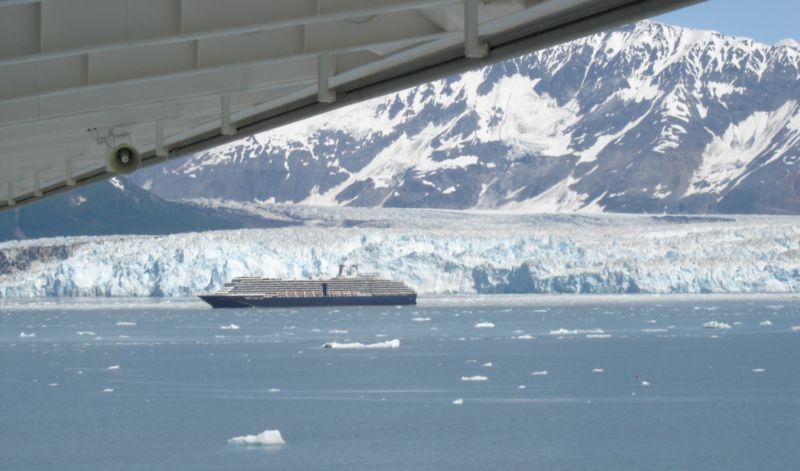
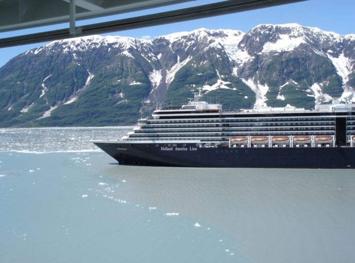
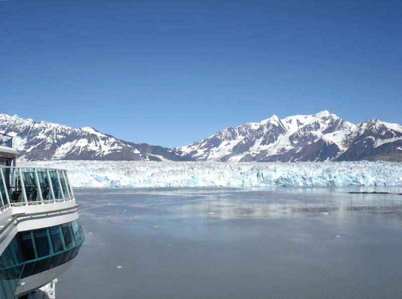
Sailing into Disenchantment Bay, Hubbard Glacier is still more than a mile away.
That little black and gray smudge in front of it – is a full-sized CRUISE SHIP!
Hubbard is one of the few glaciers in Alaska that is advancing – in fact, it’s been advancing
about 75 feet a year since 1895 when people first started taking note of it.
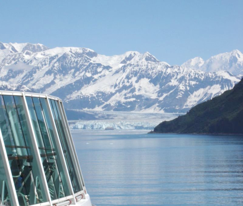
This Holland America ship, the M.S. Oosterdam, is 921 feet long.
A football field is 360 feet long; this ship is around 2.5 (American) football-fields long.
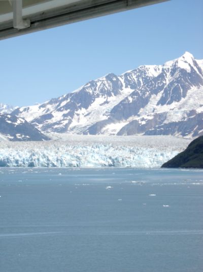
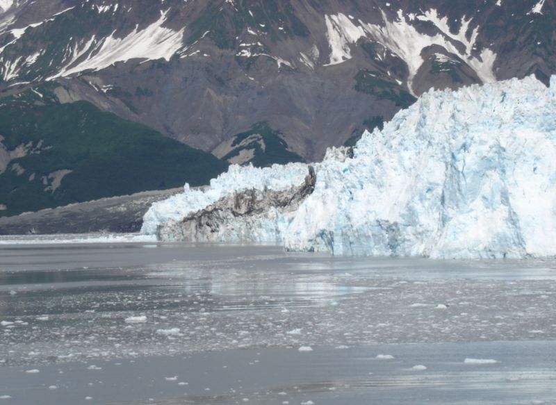
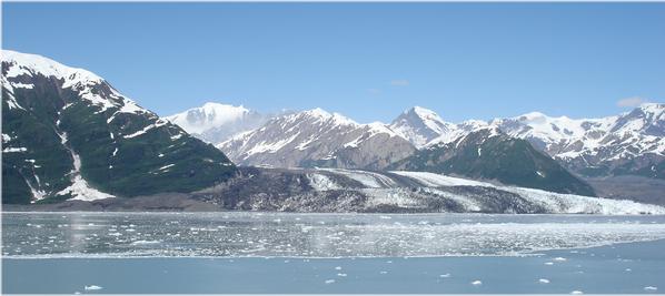
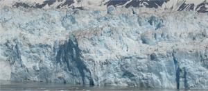
From its source on Mount Logan in the Yukon territory, Hubbard Glacier stretches 76 miles to the sea at Yakutat and Disenchantment Bays. It is the longest tidewater glacier in Alaska, with an open calving face over six miles wide. Before it reaches the sea, Hubbard is joined by the Valerie Glacier to the west, which, through forward surges of its own ice, has contributed to the advance of the ice flow that experts believe will eventually dam the Russell Fiord from Disenchantment Bay waters. The Hubbard Glacier ice margin has continued to advance for about a century. In 1986, and again in 2002, the glacier temporarily closed the connection between Russell Fiord and Disenchantment Bay.
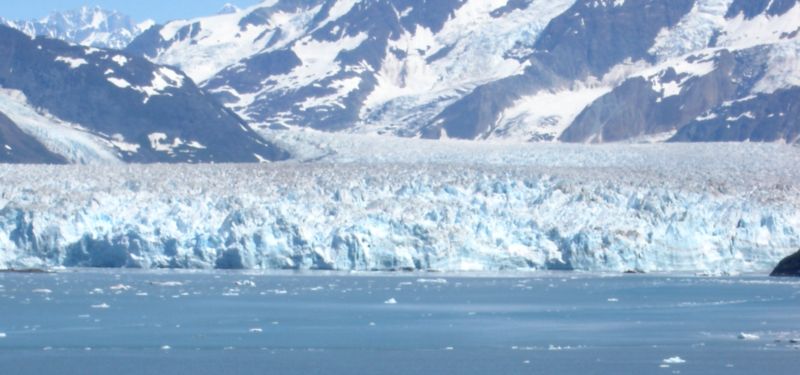
The glacier’s face is 5–6 miles wide and 400-feet tall.
Hubbard Glacier is the largest tidewater glacier on the North American continent.
There is a difference between glaciers and the ice in glaciers. Like the difference between
rivers and the water in rivers: it takes a few weeks for water to travel the full length of the
Mississippi river; however there has been a Mississippi River for thousands of years.
Likewise, glaciers have existed in the mountains ever since the ice age, but glacier flow
moves the snow and ice through the entire length of the glacier in 100 years or less.
So, most of the glacier ice in Alaska is less than 100 years old!
(http://ak.water.usgs.gov/glaciology/FAQ.htm)
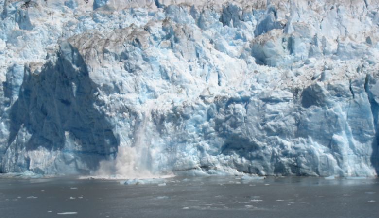
Glaciers calve when giant pieces of ice crack off the head of the glacier and fall into the sea.
(From: http://www.fs.fed.us/r10/tongass/hubbard/index.html)
The left-most (western) edge of the glacier face.
There are 616 officially named glaciers in Alaska, and many more unnamed glaciers.
The Alaska Almanac estimates that Alaska has 100,000 glaciers – that’s a pretty good estimate.
(http://ak.water.usgs.gov/glaciology/FAQ.htm)
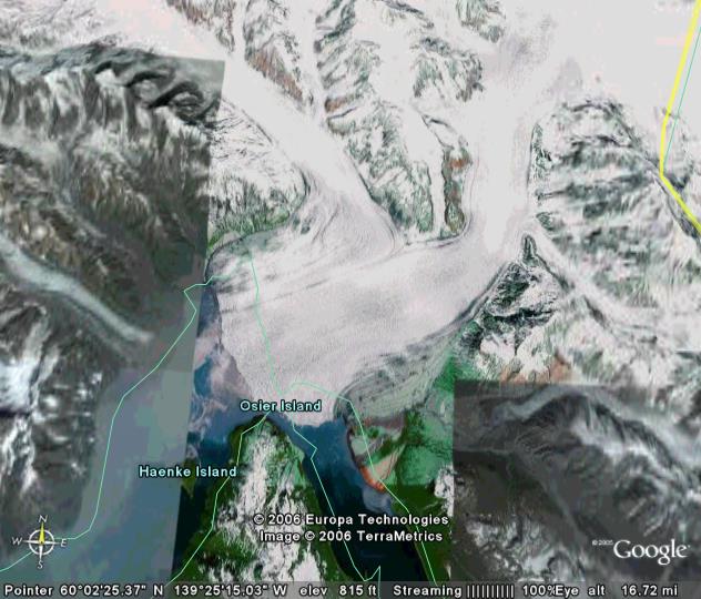
Russell “Lake” (fjord), the inlet/outlet.
Hubbard’s calving has produced the slurry of ice seen in the foreground of the photos,
as well as the growing mass of ice bergs collecting behind the constriction at the
head of Russell Fiord/Lake.( http://ak.water.usgs.gov/glaciology/FAQ.htm)
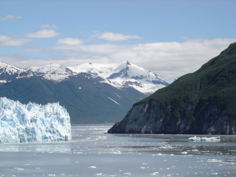
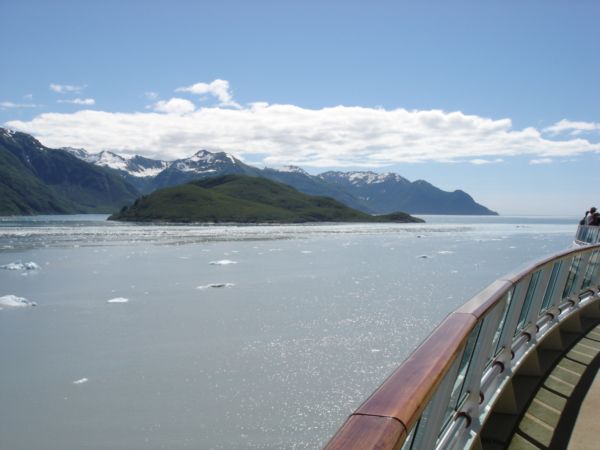
Sailing into Disenchantment Bay
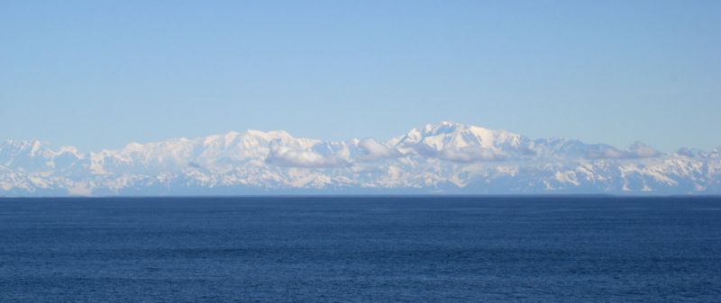
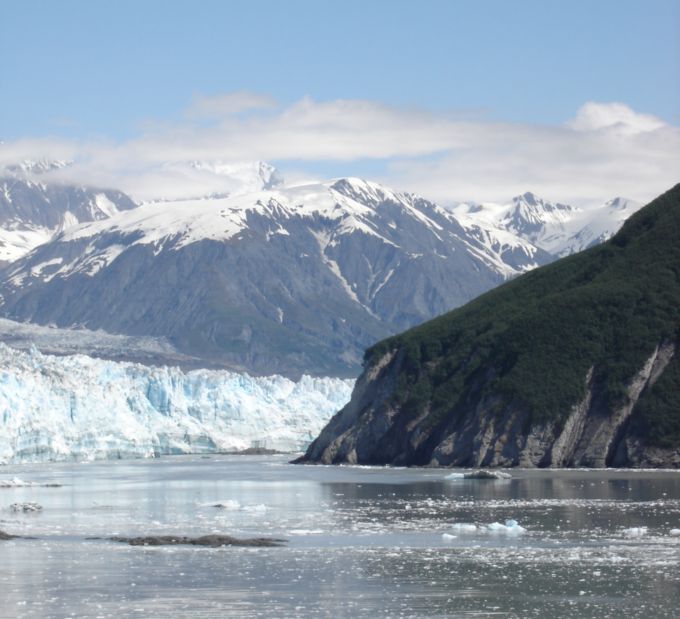
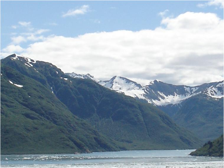
This mountain range is the northern arm of entry to Disenchantment Bay.
Mt Elias caps the range.
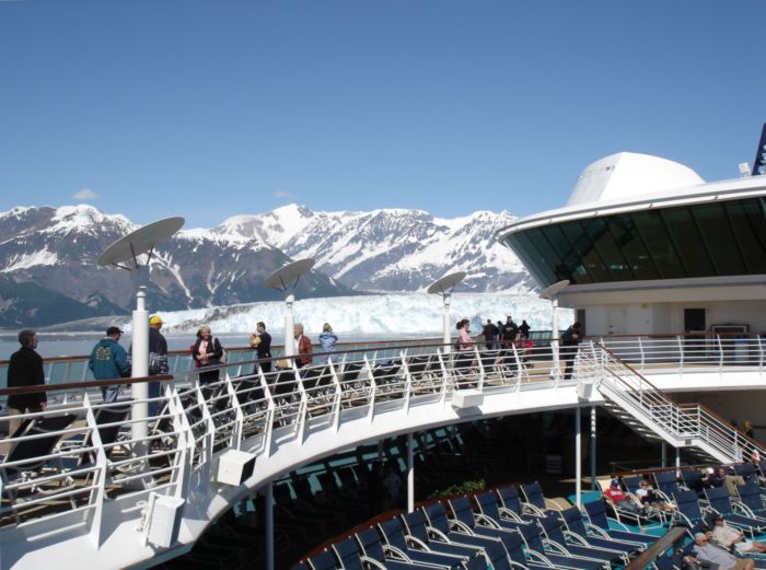
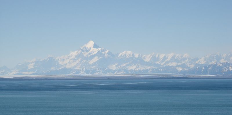
You can see the glacier for several miles.
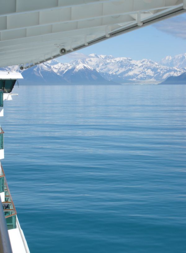
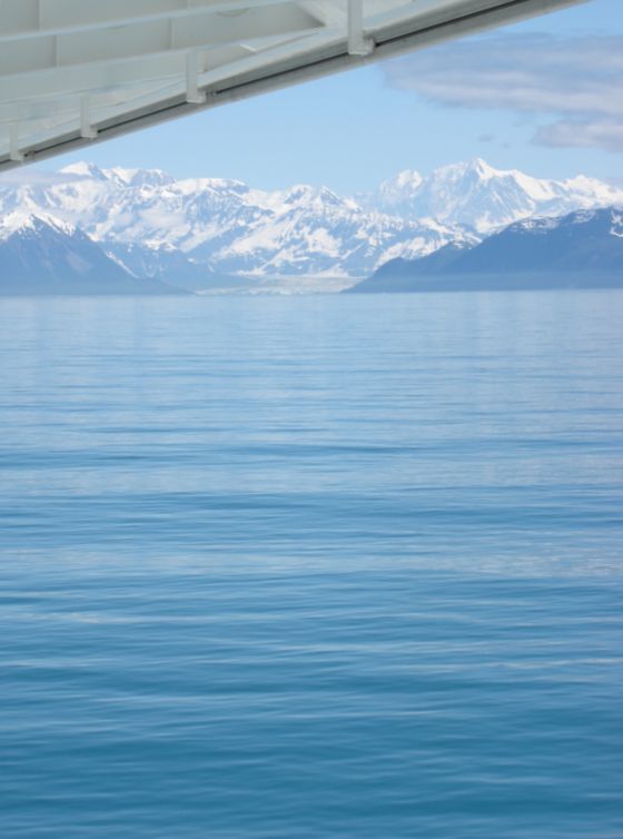
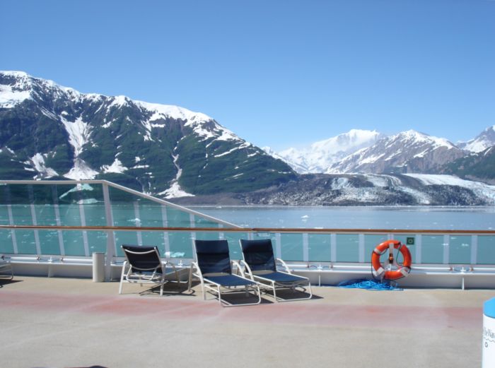
We had fantastic weather: sunny, warm (for Alaska!) and calm, calm seas.
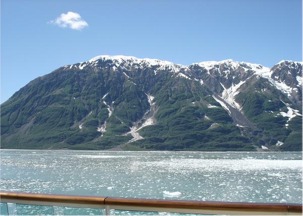
Starboard side, seaward of Turner Glacier
Starboard side, sailing into the bay
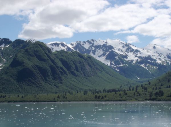
Port side sailing in.
Port-side, sailing back out of Disenchantment Bay
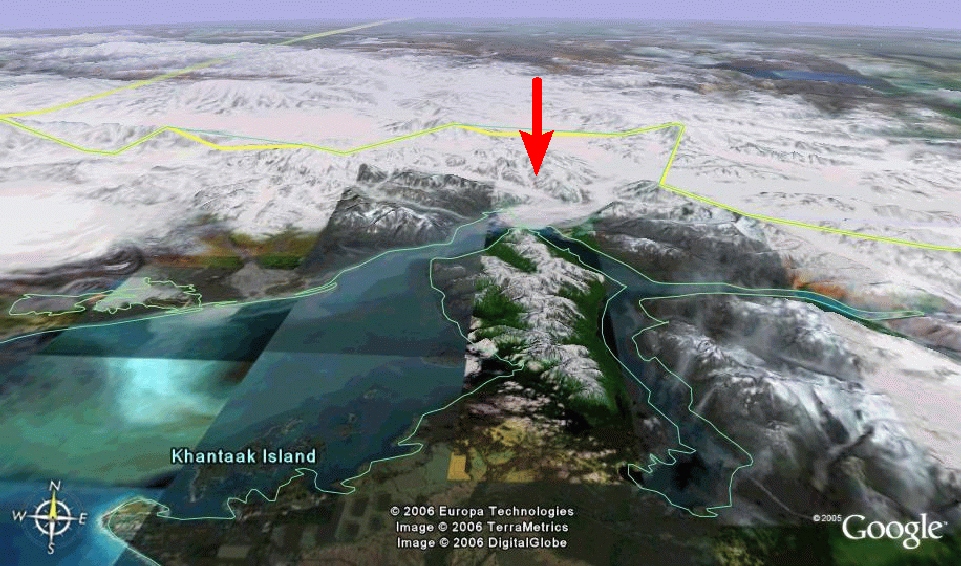
I believe this is Khantaak Island, guessing from the Google Earth map below.
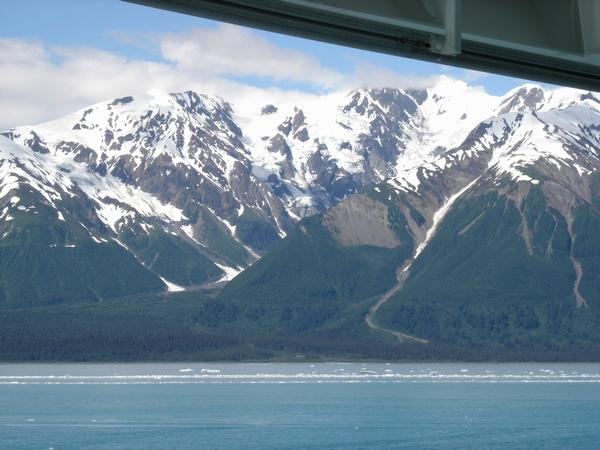
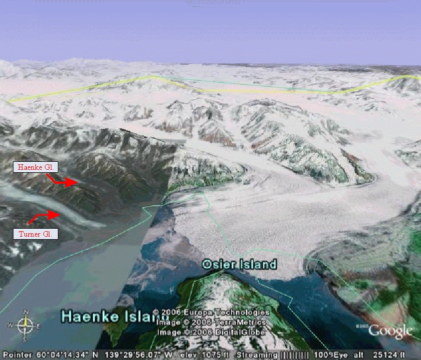
Turner and Haenke Glaciers
You can see a little bit of the Haenke Glacier – all dark dirt on top
just to the right of Turner Glacier (going up behind the middle hill/mountain).
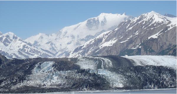
Turner glacier head-on.
Large (amazing, fantastic, astonishing) pix
Movie of the Glacier Calving
This is a short “movie” of the glacier “calving.” It’s an .MPG and is 19.2 MB in size. Click on the picture, and if your browser is set up to do so, it will begin to play it (streaming). If not, right click on the picture below and and choose “Save Target As…” to copy it to your hard drive.
Google Earth maps
Click on thumbnail to see larger/visible picture.
 |  |
 |  |
Hubbard originates on the slopes of Mt. Logan 76 miles away in Kluane National Park, and spreads across a valley 40 miles wide. By the time it reaches Disenchantment Bay, its architecture towers 40 stories high, dwarfing even the largest cruise ships.

USGS satellite view