

Before the volcano blew, the island was called Stroggili (“round”), from its shape. The volcano exploded around 1625 b.c. The tidal wave caused by the explosion is estimated to have been around 100 meters high. The ocean presently reaches down as much as 480 meters below sea level inside of the cliffs that are the caldera walls, which rise up as much as 300 meters above sea level. The disaster may have been the basis for Plato’s writings on the lost continent of Atlantis. The name of the town and the island are interchangeably spelled Thira and Fira (and to judge from the map below, Phira!).


(From a postcard)
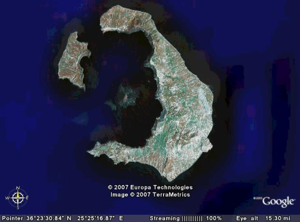
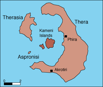
After the independence of Greece, the island was officially named “Thira.” However, since the maps continued naming the island “Santa-Eirini” the island remained known by the Greeks as “Santorini.”). Thira comprises five islands in the Cyclades. The largest island is Thira with the main town of Thira/Fira. The second largest (part of the caldera rim to the west) is Thirasia with the town of Manolas. In the center of the caldera are the basaltic volcano cones of Nea Kameni (new Kameni), and southwest of that, the older cone called Palea Kameni (Ancient Kameni). The smallest island is Aspronisi (White Island), also a part of the caldera wall. Eleven eruptions since 197 b.c. have made the two islands.
The most recent eruption at Santorini was in 1950 on Nea Kameni, the northern island. The eruption lasted less than a month.

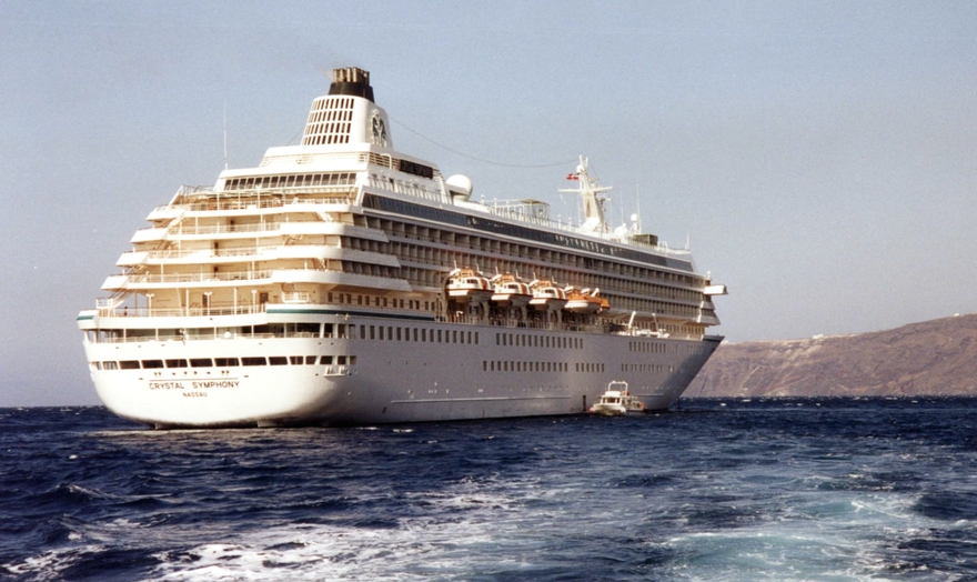
The cruise ship Olympic Countess below Fira town: We later moored next to this ship in Rhodes!


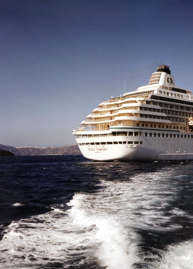
The Symphony (from the cliff-edge in Thira/Fira) between Thira and Nea Kameni. Aspronisi, the “White Island,” is in the far background. Aspronisi is so named because of the white tephra (volcanic rock) top layer, which is Minoan tephra from the 1650 b.c. eruption.

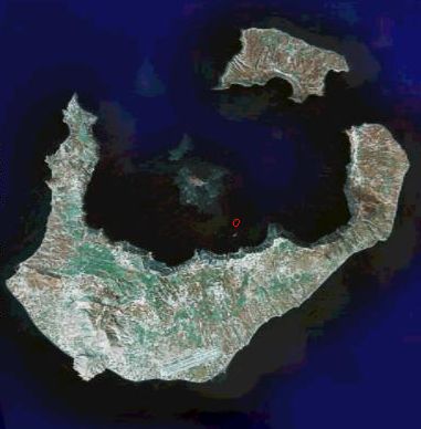
To the left is the tail end of Thira curling around toward the islands of Aspronisi and Thirasia (to the right, out of the picture).
This is the angle from which most of the pictures appear.
The red dot is approximately where the ship was anchored.

The cliffs to the left of Fira.
The Winery Trip
The Symphony sent us ashore by lighter to see the archeological dig at Akrotiri and a winery.
Going …
Going … (You can see Oia (“eye-yah”) to the far left, past a bit of Nea Kameni.)

Going … going…


The twists and turns of the zig-zag bus track up the cliff face to the winery (from the new port, not the one below Thira town).


Because of the dryness of the island, and the constant sea wind, the wine grapes are grown in “baskets.”


These protect the grapes from the wind and help retain the dew and what little rain falls.

An odd little succulent clinging to life on the island.

(In the enlarged version, you can actually see one of the lighters streaming out from Fira to the ship.)
Back in town


Mike in town.


The restaurant floor.

Looking down-down-down to the port of Thira. (And a lighter heading out to the Symphony.)
At the very right edge is a small bit of the donky path. (No, we rode the cable cars.)

In the far distance is the town of Oia.

This detail of the above gives an idea of just how large those cliffs are!


A building clinging to the cliff-edge

he Symphony from the port; Nea Kameni behind her

Looking back up-hill to Fira


The town from the water
Sailing Away

The town of Oia.
